What we have to offer
We provide the building blocks for a variety of applications and analyses.
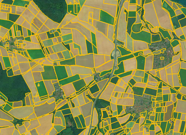
Field Boundaries
Accurate field boundaries are a solid foundation for a lot of applications. They provide spatial context and allow for numerous analyses.
Our field boundaries are updated for every vegetation season and are available from 2015. Using our API, users can query a given point in space and time for the corresponding field boundary or request an entire region as a file in a GIS-friendly format.
- Accurate
- Up-to-date
- Historical data
- Standard formats
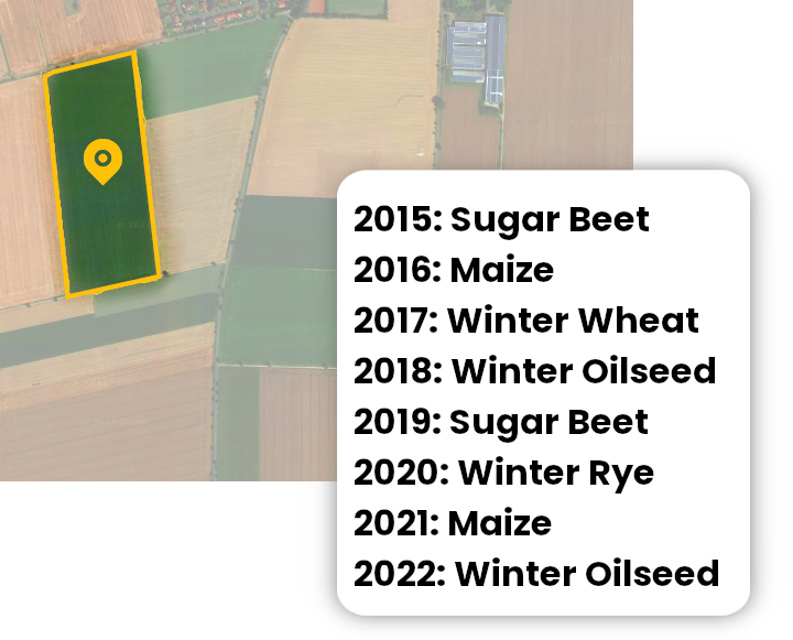
Crop Type Information
Knowledge about the cultivated crop type is a fundamental information for a wide range of further analyses and use-cases. Historical information on the cultivated crop types is available since 2015 and is updated every vegetation season.
To get the cultivated crop type for a given year and location, users can send a corresponding query to our API.
- 16 crop types
- Up-to-date
- Historical data
- Standard formats
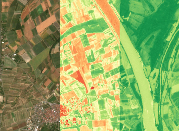
Satellite Imagery
Up-to-date satellite imagery provided by the Sentinel-2 mission is an important building block when it comes to displaying maps. Additional information is provided by derived indices, such as NDVI, which allow visual analysis.
Our service makes it possible to access Sentinel-2 acquisitions using well known formats. Additional filtering for time and cloud cover makes it easy to adjust the desired output.
- Up-to-date
- Historical data
- WMS / WMTS
- True Color & indices